

Saint Clement (Jèrriais: St Cliément) is the south-eastern parish of Jersey. It contains some of the suburbs of Saint Helier. It is the smallest parish by surface area, but the second most densely populated. St Clement stretches west to east from Le Dicq to within a quarter mile of La Rocque harbour). Its surface area is around 1,044 acres.

History
Much of the parish lies below equinoctial high-tide level and was frequently flooded before Le Dicq was built to hold back the sea. There are remains of a submerged forest underneath the sand at Grève d'Azette that show how the parish has reduced in size as the sea has advanced. Large floods in 1688, 1796 and 1812 led to the coast road at Le Hocq being swept away by the sea and necessitated it being rebuilt further inland.
In pre-Norman times, the area now known as St Clement was known as Petravilla or Pierreville. In 1172 it was recorded that a chapel existed in the parish, and there was a priory on the site of the old Priory Inn (now houses).
In the 16th and 17th centuries the parish was believed to be the centre of a witch movement. According to beliefs, the rock at Rocque Berg (known as the Witches' Rock) was the focus for witchcraft and witches would assemble there for their sabbats on Friday nights.
After the revocation of the Edict of Nantes in 1685, many French Protestants settled in the parish – as recorded on the church register.
In the mid 19th century, the town began to spread east from St Helier into the west of St Clement. Today there is relatively little open green space (with the exception of the golf and football fields) west of Samarès Lane into St Helier.
The famous French writer Victor Hugo lived in Marina Terrace, St Clement for some time, and it was here that he wrote his collection of poems entitled Les Châtiments. It was the Constable of St Clement at the time who escorted Hugo onto a steamer bound for Guernsey when he had insulted the British Royal Family in some of his letters.
Vingtaines
The parish is divided into vingtaines for administrative purposes as follows:
- Grande Vingtaine
- Vingtaine du Rocquier
- Vingtaine de Samarès
The parish forms one electoral district and elects two Deputies.
The seat of the parish administration is the Salle Paroissiale, or Parish Hall, which is at Le Hocq. This is the newest parish hall in the island; the previous parish hall is now Caldwell Hall, on Grande Route de St Clément (St Clement's Inner Road).
Twinning Links
St Clement was the only parish in Jersey not to be twinned with a French town until, in 2010 it established links with Cancale in Brittany. It is the only parish not to have a twin in Normandy.

Churches
The parish church is an ancient place of Anglican worship located on Grande Route de St Clément. St Nicholas is a smaller, sister church, located on Grande Route de la Côte (the coast road). It was opened in 1927 after being planned, financed and largely built by the Reverend L B Lee.
St Patrick's Roman Catholic Church is on Grande Route de St Clément at Samarès.
Samarès Methodist Church is on Grande Route de la Côte.
Significant Sites
The dolmen at Mont Ubé (off La Blinerie) is believed to have been left there by a pre-Celtic race called the Iberians, in around 3,000 BC. Remains of a cemetery on La Motte(Green Island) are believed to be from later settlers. Greve d'Azette menhir is located off the coast and is partly buried by sand.
Le Hocq Tower was built in 1778 as a coastal defence against the French when they sided with the American colonies against the British.
The whole rocky inter-tidal zone that stretches along St Clement's coast from St Saviour to Grouville is part of a UN Ramsar site of special significance.
External links
- St. Clement Official Parish website
- St. Clement's Church
- St. Clement's School
- Samares School
- Le Rocquier School
Gallery

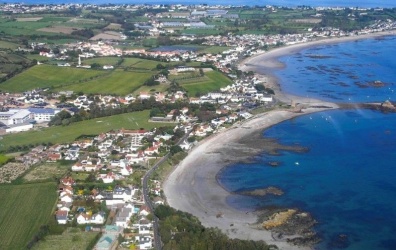

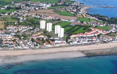
Three aerial views of the parish in the 21st century ...


Another LL postcard view of St Clement's Bay

Victorian Houses in Rue du Hocq

Rue du Hocq 1953

St Clement

St Clement coast

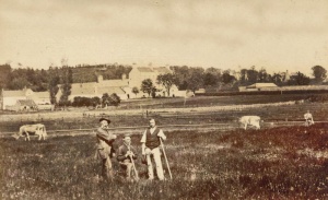
St Clement Horticultural Show in 1939

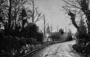
Rue du Pontlietaut

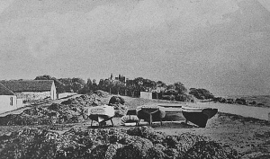
Le Bourg before seawall was built

The parish from the air in 1933 - Aerofilms picture
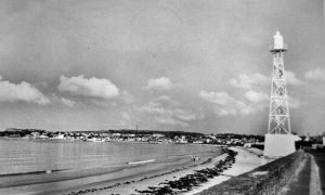
St Clement's Bay and Greve d'Azette light

La Mare beach
Jambart Lane
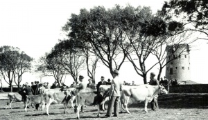
Parish cattle show in 1939, held where the parish hall now stands
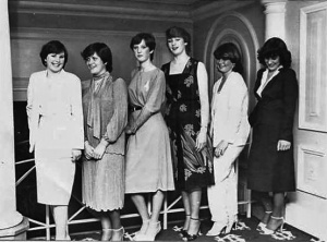
'Miss St Clement' contestants in 1981
The coast at Samares in 1908

St Clement's Bay
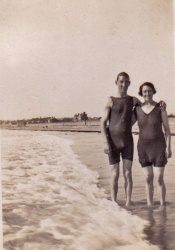
Pre-war bathing costumes in St Clement's Bay

Aerial view of the parish in 1968

The former parish hall next to the church - now Caldwell Hall

Samares beach in 1907


References
- Balleine, G R, 1970. The Bailiwick of Jersey (Revised by Joan Stevens). ISBN 0340002670